

No words will be enough to describe Ohrid. Lake Ohrid, the "Sapphire of the Balkans", bathes this little city in the Republic of Macedonia and establishes the border between the country and the neighbor Albania. Here ended the former Yugoslavia, and was also the limit of the settlements inhabited by South Slavs, or it was not this the designation of the country: Yugo (south) + Slavia (Slavic land).
The beauty of this lake is astonishing. The Church of Saint John at Kaneo (first photo), with a marvelous view over the lake and the beach with the same name, is an usual visit card of Macedonia. From here, it is possible to get a privileged panorama and see Albania, on the other side. In fact, these two countries share not only this natural border, but all the beauty from it.
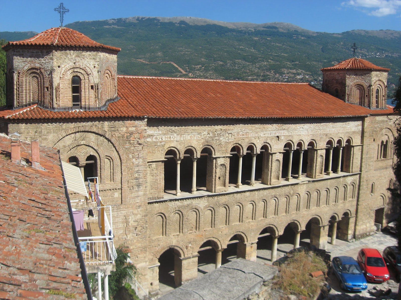
Ohrid is not only known for its natural beauty. The city boasts a unique past and, from chronicles, some of them ottoman, it was said that Ohrid had a total of 365 chapels in the past, something like one for each day of the year. Today its number is considerably lower, but the city is still full of little byzantine churches and chapels, next to imposing monasteries and cathedrals, which demonstrate the religious past and importance of Ohrid. Each church certainly has a story to tell to their visitors and inside of them there are priceless frescoes. From these temples, the most prominent are Saint Sophia Cathedral and the Monastery of Saint Clement and Saint Panteleimon. Saint Sophia Cathedral (second photo) was modeled after Constantinople's Saint Sophia and has lined columns creating pleasant arcades. Walking uphill, stands the Monastery of Saint Clement and Saint Panteleimon, originally a 5th-century basilica, with relics of these saints. Next to it, there is an apparently empty field, which is Archaeological Complex of Plaošnik, showing the foundations of a 4th-century church and mosaics of flora, birds and animal life.
The city is situated on a steep hill overlooking to the lake. At the top stands the Samuil's Fortress (third photo), named after the first emperor of Bulgaria, whose territory stretched till here and later became the capital. Ohrid has also a Roman Amphitheater, initially built to host theater, but later was used also to receive gladiators.
Ohrid is therefore a good choice for people traveling around the Balkans and looking for a combination of a rich historical and religious past with the natural beauty of breathtaking landscapes.
Quaisquer palavras serão insuficientes para descrever Ohrid. O Lago Ohrid, "A Safira dos Balcãs", banha esta pequena cidade da República da Macedónia e estabelece a fronteira entre o país e a vizinha Albânia. Aqui terminava a antiga Jugoslávia e era igualmente o limite dos povoamentos habitados pelos povos eslavos do sul, ou não fosse essa a própria designação do país: Jugo (sul) + Eslávia (terra eslava).
A beleza deste lago é indesmentível. A Igreja de São João no Caneo, com uma vista deslumbrante sobre e a praia com o mesmo nome, é um cartão de visita habitual da Macedónia. Daqui, é possível obter um panorama privilegiado e vislumbrar a Albânia, do outro lado. De facto, estes dois países partilham não só esta fronteira natural, mas também a beleza inerente a ela.
Ohrid não é conhecida apenas pela sua beleza natural. A cidade orgulha-se do seu passado ímpar e, em diversas crónicas, entre as quais otomanas, era afirmado que Ohrid possuía ao todo 365 capelas, qualquer coisa como uma para cada dia do ano. Hoje o seu número é consideravelmente inferior, mas na cidade proliferam ainda pequenas igrejas e capelas bizantinas, rodeadas de imponentes mosteiros e catedrais, que demonstram o passado rico e importância de Ohrid a nível religioso. Cada igreja terá certamente a sua história para contar aos seus visitantes e no seu interior encontram-se frescos de valores incalculáveis. Destes templos, destacam-se a Catedral de Santa Sofia e o Mosteiro de São Clemente e São Pantaleão. A Catedral de Santa Sofia (segunda foto) foi projectada seguindo o modelo da Santa Sofia de Constantinopla e apresenta colunas perfiladas, criando arcadas bastante elegantes. Um pouco acima, encontra-se o Mosteiro de São Clemente e São Pantaleão, originalmente uma basílica do século V, onde podem ser vistas relíquias desses santos. Logo ao lado, pode-se encontrar aquilo que parece um campo raso, mas que se trata do Complexo Arqueológico de Plaošnik, apresentando as fundações de uma igreja do século IV e mosaicos representando a flora, pássaros e vida animal.
A cidade situa-se numa colina escarpada com vista para o lago. No topo enconta-se o Forte de Samuel (terceira foto), que recebeu o nome do primeiro imperador da Bulgária, cujo território se estendia até aqui e que mais tarde viria a receber a capital. Ohrid possui também um Anfiteatro Romano, inicialmente construído para receber peças de teatro, mas que mais tarde seria usado para receber gladiadores.
Ohrid é assim uma óptima escolha para quem pretende aventurar-se pelos Balcãs e procura a combinação de uma passado histórico e religioso rico com belezas naturais de tirar o fôlego.


